 Photo: Chile Nativo
Editor's Note: With the announcement this week that Chile has established a new, 121,625-hectare Cabo Froward National Park in the Magallanes region, we’re republishing here this trekking column about hiking there that was in Issue 15 of our magazine in September 2017.
By Patrick Nixon
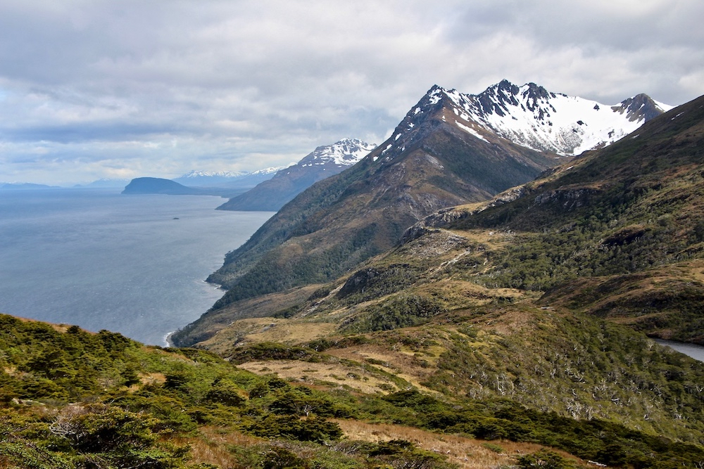
At the southernmost tip of South America, a five-day trek alongside the magnificent Strait of Magellan offers hikers the unforgettable opportunity to experience the elements of nature to the hilt. Hikers follow along cliffs, cross swollen rivers, clamber over slippery rocks and maneuver through dense forests, and then there are the isolated beaches with teams of dolphins in the distance. Though requiring low technical ability, this 50 km route is still very much a challenging trek with difficult terrain and often inclement weather including pounding wind and rains.
To get there, head south of Punta Arenas, passing the historic Fuerte Bulnes and Puerto del Hambre till you get to the end of the road. From San Isidro Lighthouse (which has a nice museum), the trail heads into jungle-like Magellanic forest and then along the coast at quiet Bahia del Aguila bay where there are the remains of an abandoned whaling station. The first day’s hike ends at Rio Yumbel with camp set up at an abandoned house of an early pioneer.
The next day, the first river crossing of Rio Yumbel can be a mere formality, that is if the river is low. But during periods of rain water can be hip-deep and cold. The trek continues through lush forest onto beaches and into a peat bog before the second river crossing of Rio San Nicolas. With the tide’s favor, the crossing here can vary from knee-to-chest-deep, freezing cold water. This evening’s camp is in a forest near Rio Nodales.
Another day, another river, on day three, as we walk on the beach to Bahia Rosas, the last bay before the cape and which offers shelter from the howling winds. We reach the Mirador Piedra La Momia viewpoint, which offers the first views of Cabo Froward. The trail climbs up to the five-story, metal cross known as Cruz de los Mares (Cross of the Seas). Erected to commemorate the visit of Pope John Paul II in 1987, the cross also marks where the Atlantic and Pacific oceans merge and is the southernmost point of continental South America. Here, walkers are rewarded with fantastic, panoramic views of the Strait of Magellan. To the east, you see the mountains of Isla Dawson and Tierra del Fuego and, on a clear day, seemingly rising from the sea to the southwest the Darwin mountain range and the mythical peaks of Monte Sarmiento come into view. Days four and five retrace the steps of our first two days.
Technical considerations
This is a trek of moderate difficulty but one must have appropriate physical fitness for walking several days with a heavy backpack. More than anything, one needs to be prepared to rough it. For anyone attempting it without a guide, awareness of the tides can make the river crossings easier and trekkers should be familiar with the trail, walking times and camping spots. Alternatively, two local tour companies offer guided trips: Erratic Rock (www.erraticrock.com) and Chile Nativo (www.chilenativo.travel). Bruce Willett, an American, who was the first to map the route in the early nineties, says that an Avenza GPS PDF map is available free for download from the Avenza store. Willett recommends doing the trek in winter, when river levels are more predictable.
The Cabo Froward trail offers a unique, historically significant get away from the crowds of Torres del Paine. “I like it because you see few people. You can also light a fire. It’s like throwback to the old unmonitored pioneer trekking,” says Bill Penhollow, co-owner of Erratic Rock. But it may not be like that for much longer. There are plans afoot to build a road to Cabo Froward to install luxury hotels and other touristic development. Do this trek sooner rather than later.